On February 3, I answered my phone and received the news that no pilot wants to hear. An emergency locator transmitter (ELT) was sending an SOS signal in the area where a friend of mine had been flying. ELTs only begin transmitting under two conditions: when manually activated by the pilot, or when triggered by high g-loads, as in a crash. We began gathering as much information as possible, and preparing for a search and rescue.
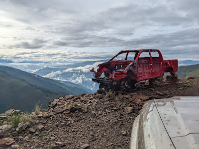
Thankfully, within a few hours the pilot was able to find a cellular signal and contact his wife. He had gotten out of the plane before it rolled away and tumbled down a steep hillside, which had activated the ELT. He was unharmed, but the airplane was totaled. Our plans shifted from a rescue operation to an aircraft recovery trip.
Although the airplane was essentially destroyed, there were still many components that could be salvaged. However, getting those parts out would not be easy. After all, there is a reason why DJ lands his Cub on a hilltop to access this region of Bolivia. Getting to the plane would require driving 14-16 hours on some rough roads, then hiking 3 hours between 11,000 and 13,000 feet above sea level. A team of mechanics and volunteers would hike in to disassemble the airplane, and the locals would help us get the salvageable pieces to a place where they could be loaded onto vehicles—at least that was our hope and prayer.
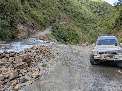
The day of the trip arrived, and I got up at 2:15 to be on the road by 3:30 am. It was an early start, but necessary if we wanted to avoid driving the worst part of the road at night. As we left Cochabamba, the road turned from pavement, to cobblestone, and finally to dirt. At times the road disappeared briefly into stream crossings, turned to mud, or became littered with loose rocks, ruts, and holes. Even the good sections required constant attention to avoid beating up my vehicle’s suspension with a constant barrage of potholes, rocks, and ruts.
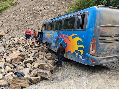
In exchange for this exhausting drive, we were rewarded with the most stunning scenery I’ve seen in Bolivia. We climbed to 15,000 feet, saw herds of llamas, and gazed over beautiful rivers and valleys. We crossed several streams that cascaded down the mountain slopes. We enjoyed good weather and smooth travels, except for the point at which a tour bus was stuck at a hairpin turn in the road. Thankfully, after an hour of maneuvering and moving rocks off of the road, the bus driver was able to continue his ascent, enabling us to continue our journey.
As we left the “main” road, it was nearing sunset. That one-hour delay had set us back, meaning that we would face the most dangerous part of the road in the dark. With limited experience in these conditions (and never having driven such roads in our Nissan Patrol), I was a bit on edge, following carefully behind the two vehicles leading the way. Many places were muddy and barely wide enough for my vehicle. Each switchback curved out of reach of my headlights, and I took them very slowly, watching carefully as each new inch of road creeped into my view. Thankfully the car did well, and I didn’t take us over the edge!
Finally, we arrived safely at our destination: a small school house where we would spend the night. The next morning we would get an early start, hiking to the site where a long, hard day’s work awaited us. But that story will require its own blog post. Stay tuned!
To be continued…


No comments:
Post a Comment